About
Why monitor the airspace?
Trillions of birds and insects use the airspace for key activities of their life cycle, such as daily foraging movements and seasonal migrations. Their movements link otherwise separated ecosystems, raise human-wildlife conflicts, and provide services and disservices that are relevant to human agriculture, economy, and health. Although the airspace is increasingly recognized as an essential habitat for a large proportion of the global biodiversity, aerial biodiversity is poorly monitored and largely absent from legislation and policy, despite it playing a similarly important role to other habitats for biodiversity and ecosystem functioning. This is in part due to the fact that monitoring aerial biodiversity remains a challenge. It involves many individual organisms, with movements often taking place at night and over a large area.
Radars as remote-sensing tools for biodiversity
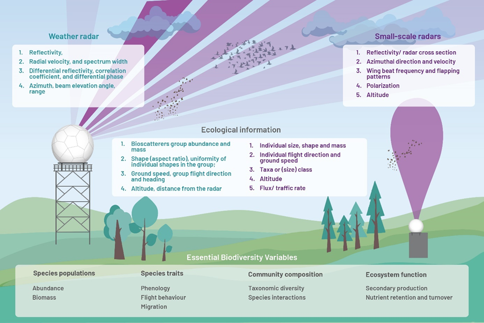
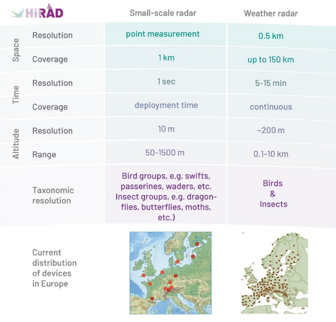
Remote sensing technologies such as radar can provide detailed information on aerial biodiversity, including the intensity, timing, altitude, and spatial scale of mass movements, for the full range of taxa and all individuals passing through the sensor’s measurement range. Various types of radar systems exist - from small-scale radars to large-scale weather radars - that are largely complementary in spatiotemporal and taxonomic resolution and coverage.
While small-scale radars (e.g. vertical looking or tracking radars) can identify individual animals and characterize their body shape, wing beat frequency, and other individual characteristics, they only monitor smaller spatial areas. In contrast, weather radars survey the atmosphere above many of the world’s large landmasses and are therefore often organized in continental networks (such as NEXRAD in the US or OPERA in Europe), covering regions of several hundred to thousands of kilometers. They also detect biological targets, albeit at coarser spatial and taxonomic resolution.
How will HiRAD contribute to establishing a standardized monitoring system?
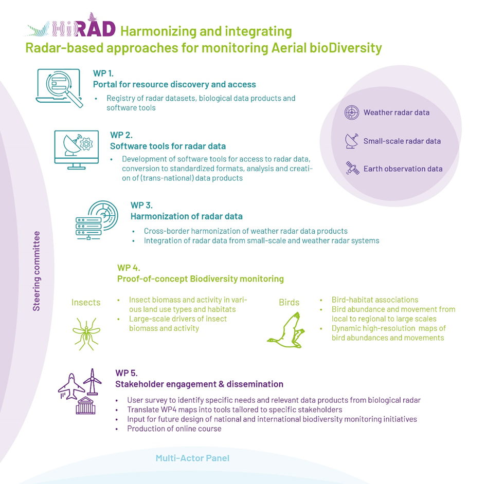
The greatest challenges for establishing weather- and small-scale radars as a standardized monitoring system of the airspace are the currently scattered distribution of radar data, biodiversity data products and software tools and the diverse formats of radar data and biodiversity products. In HiRAD, we will address these challenges, demonstrate the value of radar data in monitoring aerial biodiversity (specifically the interaction of birds and insects with biotic and abiotic factors) and create radar-based tools for various stakeholders.
To do so, we will:
- Provide access to biological data products derived from radar data across Europe (WP1)
- Develop and improve tools for the visualization, exploration and analysis of radar data (WP2)
- Harmonize data from different radar systems (WP3)
- Demonstrate their capacity for biodiversity monitoring of birds and insects (WP4)
- Provide data products and tools for stakeholders (WP5)